
Previous Residents of a Hickory Address by Era
Previous residents research is a dated trail through several custodians. Catawba County's current parcel record supplies identifiers and a deed pointer. The deed chain provides the title sequence, but not proof that every owner lived at the address. Hickory directories, newspapers, funeral records, and census schedules supply household context for their own years. Begin at the most recent reliable parcel report, save the report date, and work back only when the legal description, lot, block, or plat continues to match. A modern address alone is too fragile for older Hickory research.
| Source | Years it covers | Where held | What it can show |
|---|---|---|---|
| Register of Deeds real-estate records | 1842-present, county-described coverage | Catawba County Register of Deeds and its online portal | Recorded parties, legal description, recording date, book/page, plats, and related instruments |
| Hickory city directories | Located selected volumes, 1920-21 to 1949-50 | DigitalNC and local-history repositories | Dated name, street form, household notation, and historical work or civic context |
| Federal census and Soundex microfilm | North Carolina census 1790-1930; Soundex 1880-1930 | Patrick Beaver Memorial Library | Released household context near a directory year |
| Historic maps and Sanborn sheets | Hickory maps located for 1907, 1913, 1919, 1925, and 1931 | Catawba GIS, Library of Congress, and local repositories | Street patterns, historic map context, and building footprints |
| Obituary, funeral, estate, and probate sources | Varies by collection | Patrick Beaver, State Archives, Clerk, and library aids | Family or estate leads that need record-specific confirmation |
For a recent question, begin with parcel and deed records. For an early twentieth-century household, begin with the nearest dated directory or map, then work toward deeds and probate sources. A gap in a source is a reason to change channels, not to invent an occupant list.
Hickory Previous Residents Start with the Parcel
The Catawba County Tax Bill Search accepts an owner name, REID/LRK, PIN, tax year, or address route. Its help materials advise using one route at a time. For an address, separate the house number, unit, direction, street name, street type, suffix, and municipality. A few owner-name characters plus a wildcard can be more useful than guessing punctuation. The goal is to obtain a stable identifier, not to treat the tax display as a resident roll.
Next, use Catawba County GIS parcel reports to compare the parcel ID, acreage, subdivision, lot and block, city or tax district, and deed book/page. Catawba materials use Parcel, PIN, REID, and LRK for the central parcel number. A split parcel may retain an earlier central number, so preserve the identifier as it appears in the report. Tax owner, mailing address, and situs address are different fields. None establishes who lived at the address.
Note: The county says GIS data can change and is not the legal record, so save the report date with each identifier.
Hickory Previous Residents and Catawba's Deed Trail
The Catawba County Register of Deeds describes county real-estate records from 1842 to the present. Its online deed index is a current route, but the exact live fields, image availability, and online cutoff were not inspectable in the research. Use the office and its portal as complementary access channels. When an online search is incomplete or unavailable, the Newton office, microfilm, State Archives, and local library materials remain part of the historical route.
A useful local bridge is the Catawba deed-to-parcel helper. It accepts a deed book and page, with a four-digit book and zero-padded page, then links that citation to a parcel and map route. This makes the recorded book/page more durable than a street form that may have changed. Treat a returned parcel as a lead to compare, especially where parcels were combined or divided.
Do not confuse a sale date or assessed value with title, occupancy, or a complete history. Recorded instruments answer recorded-instrument questions. The legal description is the thread that keeps the chain attached to the same property.
Follow a Hickory Previous Residents Deed Chain
Work backward from an identified current parcel rather than from a surname alone. In a deed, the grantor is the party conveying an interest and the grantee is the party receiving it. The seller on one recorded deed can be a prior owner only for the time supported by that document. Find that seller as a prior grantee, then follow the same legal description and prior book/page reference. This keeps the trail focused on the property instead of an address spelling that may be modern, incomplete, or shared by another parcel.
- Open the current GIS report and record the Parcel, REID/LRK, deed book/page, legal description, lot, block, and report date.
- Use the deed-to-parcel helper or Register of Deeds index to locate the current purchase deed and read its grantor, grantee, recording date, legal description, plat, and prior-instrument citation.
- Search the named grantor as a prior grantee, checking that the lot, block, plat, or legal description continues to identify the same property.
- Repeat one recorded transfer at a time. Pause when a subdivision change, split parcel, estate, easement, or incomplete citation breaks the match.
- For older books, an image gap, or a portal problem, continue through the Newton office, microfilm, State Archives, and library collections rather than guessing the missing link.
- Grantor and grantee
- The party conveying an interest and the party receiving it in a recorded deed. Their names describe the instrument, not a claim about present occupancy.
- Chain of title
- The sequence of recorded conveyances followed backward through the same property description.
- Legal description
- The lot, block, plat, metes and bounds, or other recorded property wording that identifies land more reliably than a changing street address.
Keep the book/page citation even after a parcel report links it to a map. The cited instrument and its legal description are the auditable path when address labels change across time.
Previous Residents at Hickory's Changing Street Numbers
Hickory address history has a local trap. The city grid was platted during 1865-70, a street-numbering plan was adopted in 1908, and Highland and West Hickory merged into Hickory in 1931. Older directories can therefore use a number, direction, avenue abbreviation, or municipal reference that does not line up with a present address. Preserve the printed form first. A notation such as a direction or city shorthand may be the evidence needed to select the right map sheet.
Do not retrofit a current parcel line onto an earlier directory entry. Current GIS boundaries can reflect splits, combinations, demolition, reconstruction, or later street changes. The trail must stay dated at every step: directory volume, map revision, deed recording date, and parcel report date.
Map a Past Hickory Address Before Matching It
Catawba GIS's historic Hickory tax-map index provides a sheet-level route, with references to a historic Hickory map around 1907, an 1886 county map, a 1938 state highway map, and street-name PDFs. Pair the correct map year with the directory year. The Library of Congress Sanborn Hickory item can add a dated fire-insurance-map reference. These resources help test address grammar and physical context; they are not a survey or proof that a historical building equals a current parcel.
The historic tax-map index is the source for this Hickory previous residents map route.
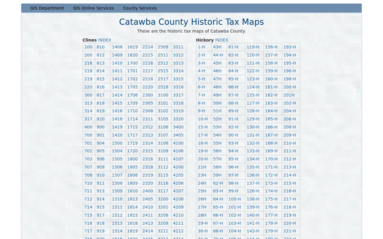
A map can show that a street pattern or lot context changed. It cannot prove the identity of a past household, so it should be paired with a dated directory, deed, census, or estate source.
Note: Record the map title, sheet, and year before comparing it with a directory or deed citation.
Match Past Hickory Households Across Directories and Census
Deeds describe title history. Past residents require a second track of household records. The located Hickory directory run has selected editions from 1920-21 through 1949-50, and Patrick Beaver holds North Carolina federal census microfilm from 1790 through 1930. The room also lists Soundex material for 1880 through 1930, the Hickory Daily Record obituary index for 1915-1989, and Shuford Funeral Home records for 1908-1957. These are separate evidence types with different dates and fields.
Directory collections themselves are available through the Hickory city directories. Use a directory year to establish a dated street form, then compare a nearby released census schedule. A census household can support a family connection; an obituary or funeral record can suggest a death date or relative. An estate, deed, or vital record is needed where the question concerns a recorded relationship or transfer.
- Transcribe the household line from a chosen directory edition, including spelling, spouse notation, street form, and any printed abbreviations.
- Check the closest available directory edition for the same address or surname, without assuming a missing volume means a move.
- Pair the dated line with the closest released census schedule, retaining its location and household details as a separate record.
- Use the obituary index, funeral records, yearbooks, church histories, or newspaper microfilm to investigate a change in the household trail.
- Return to the deed chain or estate source only when a property or relationship question requires its specific record.
Hickory Previous Residents Beyond the Online Portal
Older Catawba records do not all live in one current search screen. The North Carolina State Archives Catawba estates index offers name and date leads, while the Archives copy-request categories include deeds, estates, wills, guardians, court minutes, land grants, and other historical records. Exact copy fees were not available in the reviewed form, so a request should identify a narrow record category and date. The Evelyn D. Rhodes Room in Newton and Patrick Beaver in Hickory add library and microfilm channels.
Catawba GIS parcel help describes address, owner, subdivision, and business or landmark searching as distinct paths, along with rectangle, polygon, line, buffer, and adjacent tools.
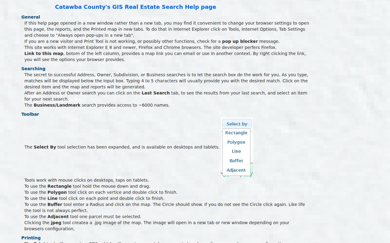
Those tools help normalize a parcel or test spatial context. They do not establish a social relationship, household membership, or who lived at a location.
Lawful Limits for Hickory Previous Residents Research
House history, family history, estate questions, and local history are appropriate reasons to keep a dated record trail. Keep only the details needed to test the historical question, and describe each source by its date and custodian. A tax owner display is not an occupancy finding. A directory address is not current identity proof. A no-result can reflect a different county, a spelling variant, a restriction, a portal problem, or a separate custodian.
Lawful use. Use Hickory previous residents records for personal history, genealogy, estate research, or civic context. Do not use a record trail to stalk, harass, or harm any living person, and respect North Carolina confidentiality protections.
Catawba offers a removal process for qualifying law-enforcement officers' identifying residence information in GIS and Tax Bill Search, while North Carolina's Address Confidentiality Program can protect eligible participants. Public access is controlled by record type and custodian rules, not by a conclusion that every visible address is complete or current.
Note: A strong address history keeps its source dates, identifiers, and uncertainty rather than turning a record sequence into a profile.