
Finding a Hickory Street Record
A Hickory street directory search works best as an address trail, not a promise of a household list. Catawba's tax and GIS tools show public parcel relationships and can lead to deeds, permits, zoning, and map context. They do not prove that an owner lives at the parcel. Voter and library sources can add a dated civic or historical lead, but each has its own limits. Start by confirming the physical address and county because a Hickory mailing label, especially near Long View, may not mean Catawba County custody.
- Enter the address in Catawba Tax Bill Search and note its Parcel ID, REID/LRK, PIN, and deed book/page if shown.
- Open the address in the GIS Parcel Viewer, select the parcel, and use its linked reports for deed history, tax, permits, school map, or zoning contacts.
- Use an official voter search only to check an individual record or election geography, not to build an address-based list.
- Take the book/page or party name to the Register of Deeds, then read the recorded instrument for the legal description and earlier reference.
- For past households, compare dated directories, census material, obituaries, and maps rather than projecting a current parcel back in time.
That sequence keeps an address, a title relationship, and a historical household from being treated as the same fact.
Hickory's city departments are a separate channel for municipal records. The Permit Center coordinates construction, development, and occupancy matters, and city planning handles Land Development Code work. County systems supply the parcel, tax, deed, elections, and Clerk records. When a record is not searchable online, ask the custodian for an existing report or document by address, parcel ID, date range, or case number. A broad request for conclusions about everyone on a street is not the same as a request for a defined public record.
Hickory Street Directory Address Checks
Catawba Tax Bill Search splits a property address into house number, unit, direction, street name, type, suffix, and municipality. Use those parts when a simple street search fails. The county's help material recommends one search route at a time, rather than combining a name, account number, and address. Partial names and a wildcard can help when punctuation or initials differ.
Historic address work needs another layer. Hickory adopted a street-numbering plan in 1908, and Highland and West Hickory merged into the city in 1931. Copy the old number, direction, avenue or street abbreviation, and city shorthand exactly before comparing it to a current GIS result. Historic tax maps, street-name PDFs, and Sanborn maps are the bridge.
ZIP labels are not a shortcut around this check. Catawba's postal map identifies Hickory North 28601 and Hickory South 28602, but postal delivery areas do not establish a city line, county line, tax district, or parcel boundary. Begin with USPS for a current mailing format, then confirm the parcel's county and city/tax district in GIS. The tax help warning about some Long View and Hickory mailing addresses being in Burke County makes that sequence especially useful at the edge.
Hickory Street Search Tax Fields
The county tax screen is a parcel-account tool. Its owner route and address route are separate, and its tax year and unpaid-bills choices are separate filters. A current balance or tax display is not final title, lien status, or occupancy evidence. Use the search to obtain an identifier, then verify the relevant recorded document.
| Visible field | Street-directory use |
|---|---|
| Owner last, first, middle | Name route with partial-name and wildcard guidance. |
| REID/LRK and PIN | Numeric parcel/account identifiers. REID, LRK, and Parcel refer to the same central number. |
| House number through municipality | Structured address route for a Hickory street search. |
| Tax year and unpaid bills | Filters for account context, not a deed conclusion. |
Catawba Tax Bill Search is the official starting screen for those fields.
The tax system can display unpaid bills, special assessments, delinquent matters, and personal-property tabs. Those are tax-system categories, not a complete legal history. Catawba's revaluation cycle also matters when comparing assessments across time: the 2023 revaluation took effect January 1, 2023, and the county lists the next one for January 2027. A change in assessed value is not, by itself, a change in title, use, or physical condition.
Hickory Streets in the Parcel Viewer
Catawba County's Parcel Viewer accepts address, owner, subdivision, and business or landmark searches. Its map supports rectangle, polygon, line, buffer, and adjacent selections. Click a result, then use the map and report links. The viewer can show zoning, parcel dimensions, old parcel lines, aerial photography, flood layers, historic tax maps, and other scale-dependent layers.
The GIS parcel screen is the address-focused visual layer for a Hickory street directory search.
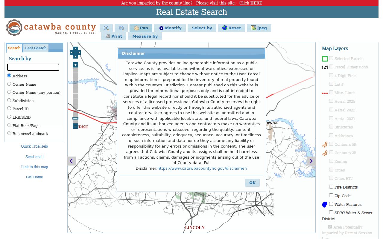
The map is informational, not a legal survey. County GIS says deed transfers are generally updated within three weeks of recording, while boundary adjustments may take up to four weeks.
The parcel card can add lot, block, plat, acreage, school, precinct, flood-panel, and zoning context. Its report links may include all owners, deed history, assessment, tax bill, permits, school map, and zoning contacts. Check the field label before using any of those values. For example, a school field or a voter-precinct layer describes geography, while a deed book/page is a pointer into a title record. The viewer cannot settle a survey dispute or verify that a historic address has kept the same parcel outline.
Hickory Records Searchable by Street
Different address-keyed records answer different questions. The parcel report establishes the county's current geographic and tax reference. The deed index supplies title documents. Permit and code records concern applications, inspections, or municipal enforcement. The voter system concerns a person's election record, while historic directories give a dated household context. Use the correct record for the question.
| Record Set | Keeper | What It Shows | Access |
|---|---|---|---|
| Tax bill/account | Catawba Tax Department | Owner display, situs, REID/LRK/PIN, tax year and assessment context | Public Tax Bill Search |
| Parcel/GIS report | Catawba GIS | Parcel, deed pointer, lot/block, zoning, district and linked reports | Public informational viewer |
| Deed, plat, or instrument | Register of Deeds | Grantor/grantee, legal description, recording date, book/page and related instruments | Office and online portal |
| Permit or inspection | SmartGov and city/county Permit Center | Application, parcel, inspection schedule/results, documents and status | Public shell; account to apply or pay |
| Historic map or directory | GIS, library, archives, DigitalNC | Earlier street form, map or dated household context | Online scans or in-person research |
Parcel number and deed book/page are more durable bridges than address wording. For a current versus historical household question, use the Hickory city-directory collections for the dated shelf instead of treating the parcel map as a past resident list.
Hickory Street Deed Connections
The Register of Deeds describes county real-estate coverage from 1842 to the present. Its online portal did not render during the research inspection, so the exact grantor, grantee, date, document-type, image, and payment controls need direct verification. The office's static coverage statement and the physical office at 100 Government Drive, Department C, Newton remain the reliable access route.
The deed-to-parcel helper asks for a four-digit book and a zero-padded page. It can connect a known citation to a Register of Deeds record, Parcel ID report, and real-estate map.
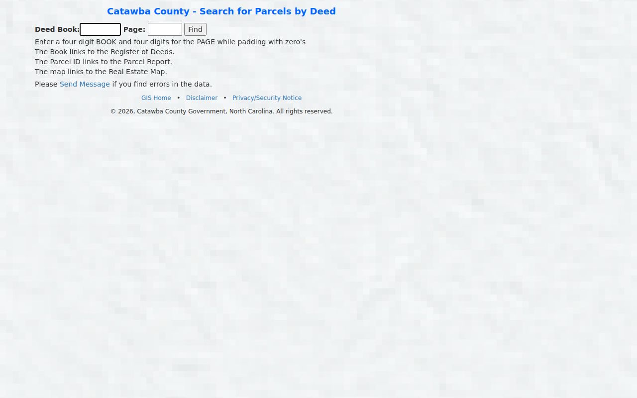
That bridge is useful after a book/page is known. It does not replace reading the deed or resolving a current parcel split.
Hickory Street Record Terms
Address records use a few terms that are easy to confuse. Keeping their meaning separate prevents a street directory search from becoming a claim about a person or boundary.
- Parcel
- A county land-record unit that can be mapped and identified by a Parcel ID or REID/LRK.
- Situs address
- The physical parcel address, distinct from the tax mailing address.
- Plat
- A recorded map that can identify a subdivision, lot, block, or other layout.
- Criss-cross directory
- An address-arranged directory. No official online Hickory run was confirmed; ask Patrick Beaver or Rhodes Room staff about holdings.
Hickory Street Names Through Time
Historic tax maps list a Hickory sheet-level route, while the county map page provides street-name PDFs by post office and city. The research also located a circa-1907 Hickory map, an 1886 county map, a 1938 highway map, and Sanborn dates of 1907, 1913, 1919, 1925, and 1931. Each document must keep its revision year. A historic footprint and a current parcel boundary are not automatically the same line.
For an old address, preserve the source-year spelling and direction, test it against the 1908 numbering plan, then compare the relevant historic map before using a current geocoder or parcel report.
Hickory Street Permit Trails
Catawba SmartGov has a public shell with Parcel Search, reports, documents, application and permit access, and inspection schedule/results. An account is needed to apply or pay. Public field labels, result columns, fee schedule, and coverage start date were not captured, so they should be confirmed in the live system. Hickory's Permit Center coordinates construction, development, and occupancy work, while county functions enforce the North Carolina Building Code within Hickory.
A permit records a process and its status. It does not establish title, present use, or who lives at the property.
If a code or permit record is needed and no public result appears, use the city or county contact route with the specific address and record category. The Hickory Police Support Services and municipal records channels are separate from the Register of Deeds and the Sheriff Records Division. Keeping the agency distinction clear avoids sending an address-based request to the wrong custodian and gives the office a usable document pointer.
Hickory Street Directory Limits
A street directory cannot reliably show every renter, household member, utility customer, delivery recipient, or current occupant. Tax mailing address and owner display are not occupancy proof. GIS map selection is geographic, not personal. Driver data is restricted, and North Carolina voter, vital, sealed-court, adoption, and Address Confidentiality Program information has limits. Qualifying sworn law-enforcement officers can seek removal of residence-identifying information from Catawba GIS and Tax Bill Search.
North Carolina's Public Records Act provides access to existing public records at reasonable times, subject to the record's exemptions and the custodian's copying rules. It does not require an office to create a street-level analysis, reveal protected data, or turn a map search into a personal dossier. A focused request should identify the record category, address or parcel identifier, date range, and whether inspection or a copy is wanted. Ask the office for the statutory basis if a record is withheld or redacted.
For a formal matter, request the record from the office that keeps it. A downloaded map or a tax-screen image is not a certified deed, survey, court file, or vital record. Preserve the custodian, source date, identifier, and any redaction note so another researcher can retrace the same lawful route.
Lawful use. Use Hickory street records for personal, lawful research, family history, civic questions, or source checks. Never use them to stalk, harass, intimidate, or harm another person.