
Hickory ZIP Code Coverage
Postal delivery areas and local government boundaries serve different purposes. On the Catawba GIS postal map, 28601 is Hickory North and 28602 is Hickory South. USPS destination materials also use 28603 for Hickory, but the research does not establish its current classification. It may have a PO Box or unique use in some contexts, so an official current USPS check is needed before describing it as a zone. The surrounding entries on the county postal map are useful for edge checks, not as additional Hickory city ZIPs.
| ZIP | Areas covered or local use | Postal designation | Records note |
|---|---|---|---|
| 28601 | Hickory North delivery area and nearby mailing addresses | Hickory | Delivery geography, not a city or county line |
| 28602 | Hickory South delivery area and nearby mailing addresses | Hickory | Check municipality and tax district in GIS |
| 28603 | Hickory identifier in USPS destination material | Hickory | Verify the current classification in USPS lookup |
| 28609 | Catawba delivery area | Catawba | Not a Hickory city ZIP |
| 28610 | Claremont delivery area | Claremont | Verify the parcel municipality separately |
| 28612 | Connelly Springs delivery area | Connelly Springs | Nearby county postal area |
| 28613 | Conover delivery area | Conover | Distinct municipality and postal place |
| 28637 | Hildebran delivery area | Hildebran | Check jurisdiction for edge addresses |
| 28650 | Maiden delivery area | Maiden | Distinct postal place |
| 28658 | Newton county-seat postal area | Newton | Many Catawba custodians use this address |
| 28673 | Sherrills Ford delivery area | Sherrills Ford | Not a Hickory city ZIP |
| 28682 | Terrell delivery area | Terrell | Nearby county postal area |
Hickory is in Catawba County, while Newton is the county seat. That is why a Hickory address can lead to county Tax, GIS, Elections, Register of Deeds, or Clerk resources in Newton. The postal map helps orient a search, but it cannot identify the correct records custodian by itself.
Hickory ZIP Maps and Delivery
USPS explains that postal delivery areas do not necessarily follow city, town, or county boundaries. Use a delivery lookup to normalize the mailing address, then use Catawba GIS for parcel geography. Keep the house number, unit, direction, street name, type, and suffix intact. Catawba tax help separates those parts into its own fields, which is useful when a broad street search returns nothing or too much. A current postal result should be saved as a date-stamped delivery fact, not treated as a legal boundary determination.
Open the USPS postal lookup with the full street address and city or with city and state when only a broad check is available.
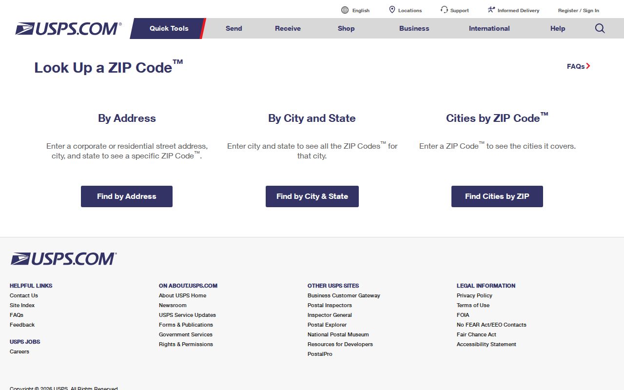
The USPS form is the current route for a delivery result. It does not substitute for a parcel report, a tax district, or a city-limit map.
For historic work, retain the directory's printed street form and year alongside the modern normalized address. Historic volumes can abbreviate street types and directions, while a current delivery label can obscure the older address grammar.
Hickory ZIP Parcel Analysis
Catawba GIS Parcel Analysis is the local tool that actually offers a postal-area filter. It can narrow a countywide parcel set by postal area along with city, township, acreage, value, vacant status, property type, sale price or date, and subdivision. The result is a parcel research set, not a list of occupants. Parcel cards can then be read for the GIS identifiers, situs and mailing distinction, city or tax district, deed book and page, and other fields that explain which source should come next.
| Parcel Analysis control | How it helps |
|---|---|
| Postal-area filter | Narrows the parcel set by postal delivery area. |
| City and Township | Tests geography that a ZIP label does not settle. |
| Sale price or date | Places a result in a dated transaction context. |
| Property type and vacant | Describes a parcel category rather than a person. |
| Subdivision, acreage, or value | Further narrows a map and report search. |
Use the Catawba GIS Parcel Analysis filters to choose a postal area, city, and other parcel conditions before opening a report.
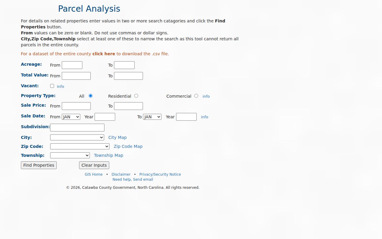
The filter set makes a ZIP useful for narrowing a geography. A tax mailing address or owner field in the resulting parcel record should not be treated as proof that someone lives there.
Finding Hickory Residents by ZIP Code
Use postal data to set a geographic frame, then move to the record system that can answer a limited question. Parcel Analysis can filter by postal area. The Tax Bill Search accepts address components and tax or account identifiers, but the inspected help does not show a simple ZIP-only resident roll. The voter lookup uses county, not ZIP, and its public information is organized around precinct and district. That difference keeps a postal search from overstating what a record can prove.
- Confirm the current mailing result with USPS, preserving the unit and directional suffix.
- Use GIS Parcel Analysis with the postal-area filter, then add city or township where an edge address needs a jurisdiction check.
- Open an individual parcel report only when a parcel question exists, and preserve the report date and identifier.
- Use Catawba Elections or the state voter lookup for a registration or precinct question, not as a ZIP-based household list.
- When the search narrows to a named street, use the Hickory by-street directory for the address-keyed record trail.
County voter-file requests are available through Catawba Elections with delivery details and stated fees for a CD, printout, labels, and postage. The state registration files are updated weekly, but their categories and confidentiality rules still apply. A ZIP label should never be used to infer a person's precinct or city jurisdiction.
Hickory ZIP Voter Context
The North Carolina State Board of Elections Voter Search has first name, middle initial, last name, optional year of birth, county, and voter-status controls. Select Catawba to narrow a search only after the address has been checked. A county is wider than Hickory, and a precinct or election district can differ from both a city boundary and a postal delivery area. The public result may include status, precinct, jurisdictions, polling place, sample-ballot link, absentee information, and voter history.
G.S. 163-82.10 protects SSNs, full or partial dates of birth, email, photo-ID copies, driver-license numbers, and protected addresses. North Carolina's Address Confidentiality Program also protects qualifying participants through a substitute address. A no-result can reflect a spelling variant, a restriction, a different county, or an inactive category. It is not a reliable statement about a person's connection to a ZIP area.
Note: Keep postal geography and election geography in separate notes so a later precinct result is not mistaken for a ZIP boundary.
Hickory ZIP Code Boundary Checks
At the edge of Hickory, a mailing city and a city limit can point in different directions. Catawba tax help warns that some Long View or Hickory addresses may actually be in Burke County. Compare the USPS result with the GIS city and tax-district layers, the parcel report, the deed custodian, and the planning jurisdiction. If they differ, record each source and its date rather than quietly choosing the label that seems most familiar.
The Catawba postal map is a delivery-area map, not a legal municipal map. It shows why 28601 and 28602 are practical starting points, yet cannot settle whether an address is in a city, a county, a school district, or a particular parcel. City, tax district, precinct, and postal area are each separate fields on the local record trail.
- ZIP and ZIP+4
- A ZIP identifies a postal area; ZIP+4 is a more precise delivery route, not a parcel boundary.
- PO Box ZIP
- A postal identifier used for box delivery. Its current status should be checked in the USPS lookup.
- Unique ZIP
- A ZIP used for a particular organization or delivery arrangement rather than a municipal boundary.
- Carrier route
- A postal delivery sequence that can be narrower than a ZIP but does not establish ownership or city limits.
Hickory ZIP History and Addresses
Postal labels are current research tools, while historic street evidence needs the map and directory conventions of its own time. Hickory's grid was platted from 1865 to 1870, a street-numbering plan was adopted in 1908, and Highland and West Hickory merged into Hickory in 1931. These are reasons not to put an old directory line straight into a current lookup and assume the match is sound.
For a historic address, keep the printed street, avenue, direction, and volume year. Then compare the 1908 numbering context with historic tax maps, street-name PDFs, and the 1907, 1913, 1919, 1925, or 1931 Hickory Sanborn map years when relevant. Current GIS parcels and old fire-insurance footprints are not one-to-one because parcels can split or combine, buildings can change, and streets can be renamed.
The USPS Postmaster Finder by ZIP has historical From ZIP and To ZIP inputs. It is useful for postal history, but the tool itself warns that historic post offices may not be current.
Hickory ZIP Data Dates
Every postal or parcel result should carry a source date. Catawba's tax cycle had a revaluation effective January 1, 2023, with the next scheduled revaluation in January 2027. A value difference across those dates may reflect the revaluation period rather than a change in the physical property. Likewise, a delivery result can change while an older directory or deed remains valuable for its own date.
When an online tool cannot answer the question, use the custodian's fallback route. GIS and 911 Addressing handle local parcel or addressing questions; the Register of Deeds holds recorded instruments; the Tax Department controls its display; Elections controls voter information; and local history rooms hold older directory and map context. Ask for an existing record, identify the date range and desired format, and retain the returned record number or URL.
Boundary rule. A postal delivery label is useful evidence for mail, but verify city, county, parcel, and precinct separately before relying on it for a records search.